Posts in Waikato
Here's why Mount Tauhara is definitely worth the climb

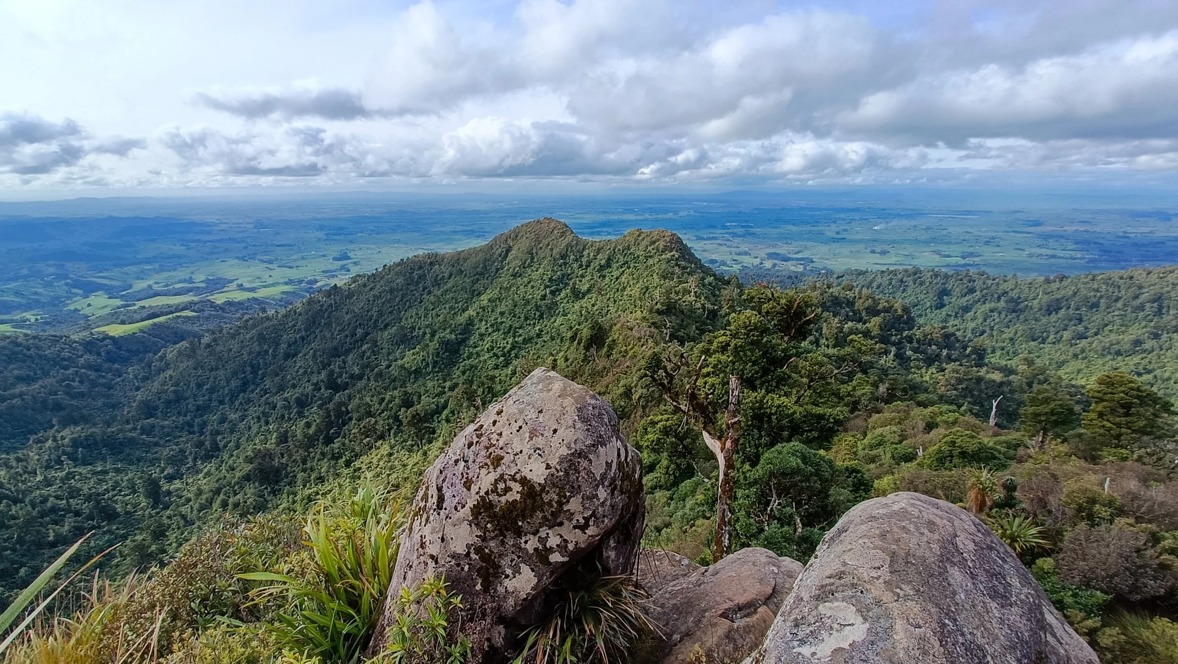
Mount Tauhara is a 65,000 year old dormant lava dome volcano, the gentle giant that stands as gatekeeper to Lake Taupō. The 2.5km track to the summit (1,088m/3,570ft) is popular with locals and visitors alike. At the top, the tall fella and I were treated to panoramic views of the district, and even as far as the peaks of Tongariro National Park.

After a weekend of foodie indulgence for our anniversary, a walk up Mount Tauhara was a must-do before heading home to Whakatāne. After downing coffees and bacon butties at the Sunday market (Aaron was stoked that the butties came with HP sauce), we drove the 10 minutes out of Taupō to the Mount Tauhara carpark. The car park is at the end of Mountain Road, just before a gated working farm.

Read More
Pahāutea Hut via Tirohanga and Maraukura Loop in the Pirongia Forest

Some adventures don’t always go to plan, and in the seven years I’ve been solo hiking, this one takes the cake! I had been on a road trip in the North Island performing poetry and had a few days up my sleeve in Hamilton before my next gig, so I decided to head to nearby Pirongia Forest. I parked up at the Grey Road car park (by the Pirongia Forest Lodge) with the intention of an overnighter to Pahāutea Hut via Tirohanga Track then walking out on the Maraukura Track the following day. If you want to do the loop, start on the Mangakara Nature Walk from the car park, then look out for the Ruapane Trig Lookout connection track. According to the DoC website, it’s easier to walk-in via Tirohanga Track, and I would have to agree with them.

Pahāutea Hut is about 30 minutes from the 959m Mt. Pirongia summit. Unfortunately there was thick fog at both times I went past, so I don’t have any photos of the views. It’s a 20-bunk bookable hut with several campsites nearby. There are multiple tracks that lead to the hut, so check out the DoC website for up-to-date track conditions. The terrain was often a challenging steep scramble, rooty with glorious thick mud that leads to incredible views (when the fog clears). Being in the middle of winter, the sooner you accept the bog, the quicker you’ll move past it.

There are chains on parts of the track (before and after the trig) - these definitely came in handy as the rocks were slippery from the rain. It took me back to my rock climbing days, and these short legs did have to tap into some short-girl-beta. If you’re a scrambler like me, take extra care that you don’t grab onto the pockets of gorse or cutty grass hiding in the bush - damn, that shizz hurts!

Read More
A winter roadie to Lake Rotopounamu and Waihāhā Hut

The first time I heard about Lake Rotopounamu was before my workmate went on maternity leave (she just came back to work a few months ago after a year off). I’ve driven past it a couple of times on my way to hikes in the Tongariro National Park, and I’m stoked that I tagged it onto my hike to Waihāhā Hut in the Pureora Forest.

Parking for Lake Rotopounamu is on Te Pononga Saddle Road (SH 47), about a 10 minute drive from Tūrangi. Look for the DoC sign across the road.

Lake Rotopounamu is said to be the heart centre of New Zealand, and I get it, listening to the abundant birdsong and walking amongst giants, time slows down. I’ve felt that in forests before, then again I love forests for that reason. What got me were the moments when the lake suddenly came into view. It takes you a few seconds to realise that the world isn’t upside down, but that the skies are so beautifully reflected on the water. 

The track is family-friendly - the loop is well marked and steady underfoot. It’s approx. 5km according to my watch. The track goes uphill in the beginning, but evens out after about 15 minutes. Most of the track is under a canopy, with plenty of lake access along the way. A section of the track is lakeside which was a nice break to walk in the sunshine before heading back into the forest. The loop took me around 1.5 hours, with plenty of time to enjoy the birdsong and take lots of photos.

Read More
Women’s weekend overnighter at Daly's Clearing Hut

Saturday night was pretty special - it was warm enough to spend a couple of hours looking up at the Milky Way, telling bush stories and laughing at life. We even spotted a few shooting stars that I later learned were the tail end of a meteor shower. There is a fire pit in front of the hut, but with all the recent rain there just wasn’t any dry wood around. One by one people started going to bed, and I seriously thought about sleeping out on the deck. But I knew rain was coming too, and I was glad to be warm in bed when I heard it dancing on the roof at 5am.

This was the biggest group I've hiked with ever - four newbies and my regular adventure buddies, Katri and Tia. I organised a beginner’s overnighter for the weekend - an idea that came from some followers on Facebook who I already knew through different circles. Whakatāne is a small town with two degrees of separation after all. I have hiked most of the Kaimai-Mamaku Forest before, and Daly's Clearing Hut is definitely the most accessible for beginners. The quickest route is less than two hours from the car park.

Our group met at the Franklin Road car park around midday. The plan was to walk alongside the Waitawheta River, the same track I’ve taken to Waitawheta Hut previously. It's lovely flat terrain that's really more of a walking track. You can see remnants of the historical tramway, which were used to transport the giant Kauri they were milling. We walked for about an hour through farmland and bush until we reached the Daly’s Clearing Track junction.

Read More
Day hike to Mangamuka Hut on Te Tuhi Track

Mangamuka Hut can be accessed from SH 29 along the North-South track, or via Te Tuhi track, starting at Te Tuhi Road car park. The track is on the Te Aroha side of the Kaimai-Mamaku Forest, and takes about 1.5 hours drive from Whakatāne. From SH 24, turn-off into Old Te Aroha Road until you get to Te Tuhi Road. It’s a beautiful drive surrounded by farmland. The car park is at the end of the road (there are no toilets). The trailhead is at the bush edge, about 30-40 mins walk along private farmland. Walk past the gate and up the gravel road - there’s an official Depart of Conservation (DoC) track sign about 15 mins up the road. Follow the orange markers to the bush edge.

I don’t mind early starts, and the Sunday morning drive to Te Tuhi Road from Whakatāne was lovely. I missed the turn-off to Old Te Aroha Road the first time, but not far enough down the road that I couldn’t turn around. There was plenty of morning fog on the surrounding farmland, but nothing on the road. There was only one car when I got to the car park. I met the couple a few hours later as they were heading back.

Read More
North-South Track (Part 4): Motutapere Hut to Hot Springs Road

The wind and rain had slowed down overnight - I didn’t even get wet on my usual toilet mission in the middle of the night. I have to remember to start packing my glasses on overnighters, as putting on my contact lenses while half asleep isn’t ideal. Even without the fire, the hut had stayed warm and dry. I braced myself as I opened the door, expecting to get whipped in the face with wind and rain. There was a bit of wind and mist, but I managed to stay dry on my quick dash to the bushes.

I had arranged for my parents to pick me up at 3pm at Hot Springs Road in Katikati. The plan was to head north until the Tuahu Track junction and walk out that way - Tuahu Track can be walked from Te Aroha side of the Kaimais too. I figured I would have some mobile coverage by then and I can adjust my pick up time if needed. It usually takes about 1.5 hours to drive from Whakatāne, and more that day because of the summer holiday traffic.

Read More