River exploring in the Ikawhenua Ranges

How to get to the start of the track
The gravel road leading to the car park is on 539 Troutbeck Road according to Google - it’s a sharp left between the Mangamate Stream bridge and a Stihl flag outside the farmhouse next door. Check out the Google link below. Like any rural gravel road, there are plenty of potholes, so drive carefully. Keep going until you get to the end of the road where there’s a small dirt car park. Walk down and cross the river - there are pole markers that will take you into the bush where you will find the Mt Tawhiuau sign.
The trail I followed isn’t an official track, so take your fitness and backcountry navigating experience into consideration when going off-trail. It requires multiple river crossings, which can be dangerous after heavy rainfall. Be safe and always be prepared to turn back.

At the first lookout - the view of the Ruarepuae Stream and dense bush below.
“Leave it! No! Leave it!” I thought I was alone on the track when her voice boomed through the birds and the light breeze. A few minutes later, I saw a woman walking towards me carrying a dead possum in her left hand, with a dog on her right. The dog seemed proud of his find, and somewhat annoyed that the woman wouldn't let him enjoy it. “I’m trying to find a tree high enough to hang it on so he can’t get to it next time.” We both laughed. She must have been a local living nearby, there weren’t any other cars parked up when I got there.
I was back in the Ikawhenua Ranges in Galataea - I had walked up Mt Tawhiuau a few times, but had never the Galatea Foothills Track. It was a good morning for it, almost-spring weather meant a couple of layers but rain wasn’t on the radar that day. The Kahikatea canopy stood tall, but not thick enough that sunshine couldn’t get through to the forest floor.

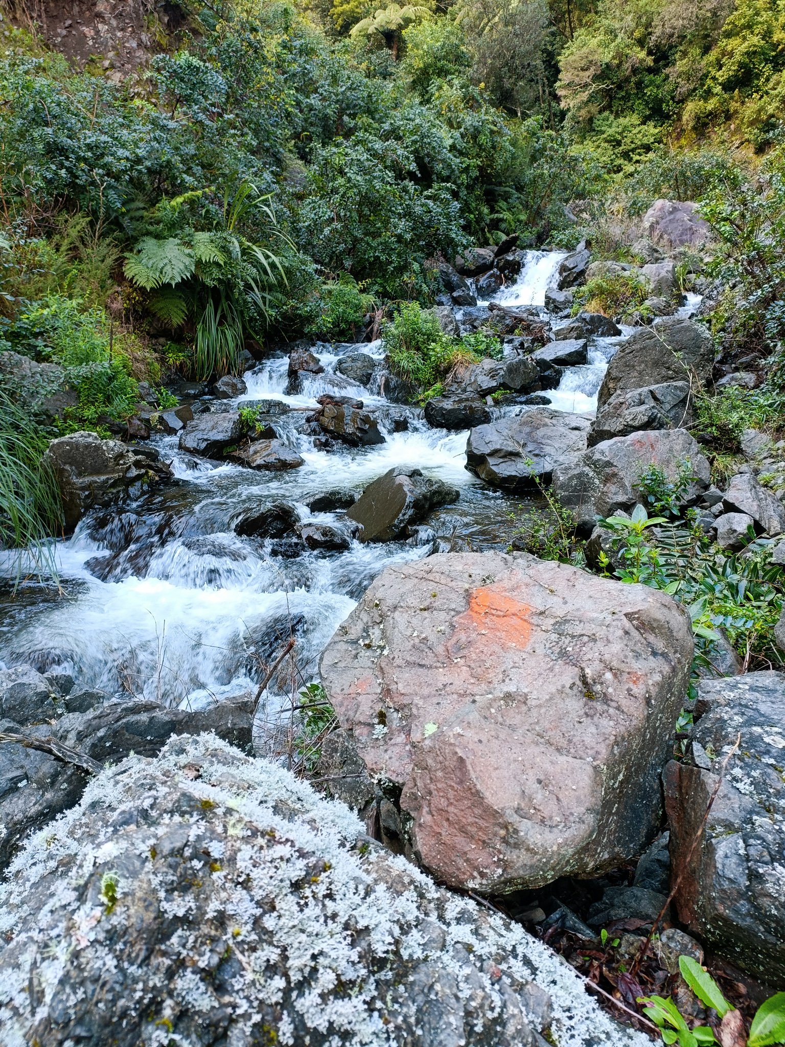
It was quite the adventure following the blue markers.
The track starts at the trailhead of Mt. Tawhiuau, but instead of going straight up, you turn left. Even though I followed the Foothills track for a couple of kilometres, I decided to go river exploring instead. There are a few good lookout spots on the track that show how dense the bush is on the ranges. I ended up exploring about a kilometre upstream of the Ruarepuae Stream.
Once I left the official track, the trail got rougher, narrower and threw in a few boulders for fun. I must have walked about 15 minutes before it dropped down to the river. There were blue spray paint markers on trees and boulders which made it easy to find good spots for river crossings. We did have some rain that week, but I felt comfortable with the water levels, with most crossings being below my knees (I’m only 152cm so that should give you an idea). The water was a bit fresh, but not as cold as I was expecting.

So much stoke on this face haha.
It had been a few months since I had done any river missions, so I just decided that I would head upstream until I found a nice spot for lunch then head back. I actually almost stopped at the first small waterfall because I couldn’t see any more markers. I thought I could see a trail up the hill that could bypass the stream, but it looked like too much bush bashing, and I was having none of that. Turns out the next marker was just a bit further upstream, and they were pretty easy to spot them after that.

I really liked the way this tree was growing so close to the river. I’m sure there will times part of it is underwater.
Short sections of the river were pretty flat, while the boulders I scrambled over definitely reminded me that I was walking upstream. There was only one boulder by another waterfall that gave my shorts legs a bit of grief - it was that flaky, jagged edged kind of rock that always made you question a hand grip or foothold. Luckily, it was pretty dry, so I just took my time, used some of my rock climbing training and eventually made it to the top. Trying to get back down was just as slow and awkward.
I left the rock hopping for another adventure and chose to get my socks wet instead.
It was around midday when I found a dry rock next to a pretty little waterfall. I probably could have kept going, but after seeing the much larger boulders ahead, I was convinced that this was as good a place as any to refuel. If I hadn’t heard the faint sounds of the farmland in the distance, I would have thought I was much more remote than I was. In reality, I was only less than three hours from the car park. Still, I had the river all to myself that day.
After lunch, I walked back downriver and slowly made my way back to the Foothills track. My car was still the only one in the car park. After taking off my boots and wet socks, I sat in the back of the Rav 4 and tucked into my chocolate brownie. It’s days like these that I’m most grateful for my curiosity - not only did I walk a new track, I also have a newfound love of river missions.
Catch you on the next adventure!
Ronna Grace Funtelar is a 40-something desk-fit creative, weekend explorer and cheese enthusiast in Whakatāne, New Zealand. She has a big butt, chunky thighs and shakin’ more jelly than Destiny’s Child. Her creaky knees discovered an appreciation for Type 2 adventures in the bush and mountains in her thirties, and she’s been hiking ever since.
Liked this blog? CLICK HERE to donate a coffee today.