Te Rereatukahia Hut: Sciatica, climbing over tree falls and chasing sunsets

My first visit to Te Rereatukahia Hut on my hike in April 2023.
How to get to the start of the track
Te Rereatukahia Hut is a 12-bunk bookable hut in the Kaimai Mamaku Conservation Park. There are several track options - the quickest is from Wharawhara Road in Katikati. Another popular option is from Hot Springs Road in Katikati on the Tuahu Track, which meets up with the North-South Track that leads to the hut. I hiked in via the Tuahu Track on Wairakau Road in Te Aroha. It’s not an official car park, but there is room to park cars on the grass. There are mixed reviews online about car safety, but in my experience my car wasn’t tampered with.
Sciatica for a hiking enthusiast is a b*tch, it really is. It had been a frustrating month of shooting pains and even struggling to put my shoes on, while waiting patiently for the tracks to reopen after the damage from Cyclone Gabrielle. The mountains were calling, but my body kept telling me to put my hiking plans on hold. Te Rereatukahia Hut was one of the last two huts in the Kaimai Mamaku Conservation Park I had yet to visit, Kauritatahi Hut being the other. I figured the undulating Kaimai Range was as good a test as any to see if my sciatica would let me plan any more overnighters over winter.

This tree fall would have been easy to climb over for anyone who wasn’t so vertically challenged.
I have walked the Hot Springs Road part of the Tuahu Track when I hiked part of the North-South Track a couple of years ago. Leaving the car park at Wairakau Road, the first hour took me through a gravel road and up a 4WD track surrounded by pine trees. Here’s something I’ve learned from hiking in the Kaimai Mamaku - there’s no such thing as downhill at the start of the hike. Everything goes up, and it’s usually pretty steep, but if the weather’s good, the views are spectacular. I don’t know what the track was like from the Te Aroha end before Cyclone Gabrielle, but it was messy this time round. There were three medium-sized tree falls across the track, but all could be climbed over…unless you’re five feet tall with sciatica. The first tree fall gave me the most grief - falling at an awkward angle that made it hard for me to climb over. I know what you’re thinking, it looks fairly innocent, but let me tell you that I would have great joy turning it into firewood if I owned a chainsaw.

Being short made it easier to squeeze through this tree fall.
Tuahu Track to the North-South Track junction is a bit over 6 km. After over two hours of battling tree falls, my sciatica and overall lack of fitness, I popped out of the bush and was rewarded with views of the Killarney Lakes and blue skies. I was tempted to make this my lunch stop, but the wind had picked up, so I decided to carry on to the North-South junction to see if I could find a sunny spot that was sheltered from the wind. If you want to top up your water, make sure to do it along the Tuahu Track as I didn’t come across a water source on the track to the hut.
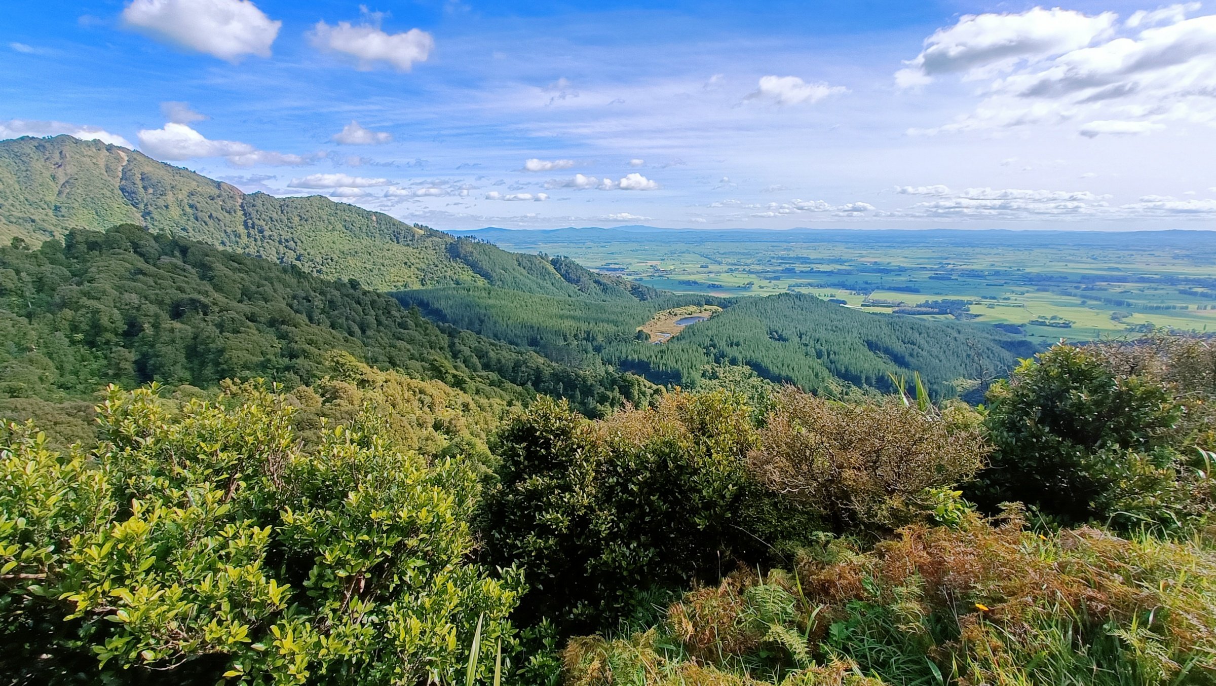
Views of the Killarney Lakes from the Tuahu Track.
The junction sign said it was only 1.5 hours to the hut - it wasn’t far off, even at my pace. This section can seem overgrown compared to the Tuahu Track, but don’t worry, the track is well marked. There are plenty of steep, rooty sections along the way. Sometimes it did feel like a slog, but each time I popped out to a clearing along the ridge, the views just kept getting better. Unfortunately, it was also along the ridge that I ran out of water. I know, what a noob mistake from someone not so new to this. It turned out that I had packed my 1.5L water bladder, instead of my 2L. It took me just over a couple of hours (with a bit of cramps setting in) to cover the 3.5 km to the hut.

It may look overgrown, but it wasn’t that hard to follow this section of the North-South Track on the way to the hut.
The 12-bunk became bookable last year, and being a long weekend, the hut was full along with three tents. It was early afternoon, but I was one of the last to get to the hut. There were four families, a group of four friends and a couple of solo hikers. Most of us cooked and ate outside as the hut layout was a bit of a squeeze. By the way, if you’re a hot sleeper, try to get a bottom bunk. The top bunk felt like a sauna when the fire was lit. Of course, this is perfect for those cold winter nights.
I woke up around midnight for my usual toilet dash, resulting in a dicey battle with the bunk ladder. During the night, a cramp had set in on my right calf as well as my left thigh, making it hard to be a ninja in the dark. In my sleepy daze, I swung myself too hard towards the vertical beam and almost overshot the ladder. I clung gingerly onto the beam, trying to figure out quickly how to get myself out of that mess. Fortunately, I managed to hook my toe onto the ladder so I would stop swinging like an awkward monkey. Apart from the usual symphony of snoring, I did manage to get a bit of sleep and safely made it down the ladder in the morning.
The predicted rain for the following day didn’t eventuate, although there was a cooler breeze as I walked back down the North-South Track. I decided to take my time walking along the ridge to really soak in the views, as I probably won’t be back for a while. I’m glad to tick off Te Rereatukahia Hut, and hopefully I’m in better shape next time I come to visit.

Sunset was at the back of the hut.
Ronna Grace Funtelar is a 40-something desk-fit creative, weekend explorer and cheese enthusiast in Whakatāne, New Zealand. She has a big butt, chunky thighs and shakin’ more jelly than Destiny’s Child. Her creaky knees discovered an appreciation for Type 2 adventures in the bush and mountains in her thirties, and she’s been hiking ever since.
Liked this blog? CLICK HERE to donate a coffee today.