Explore the breathtaking Mount Tarawera with Kaitiaki Adventures

“We have a saying on this tour - it’s easier to stop than to mop!” Everyone in the van burst out laughing. The van had reached the start of the 4WD track on our guided tour to Mount Tarawera and Dan, our guide, was letting us know that it would be a bumpy 30 minutes ahead of us. He wasn’t joking, but luckily no one gave him a reason to bring out his mop on our tour.
I had wanted to do the guided walking tour on Mount Tarawera with Kaitiaki Adventures for a while now. After months of procrastination, I found myself booking on the Friday morning (I booked through bookme.co.nz) and just like that, I was climbing a volcano the following afternoon. There were seven of us on the tour with a couple of guides, Dan K (our main guide and driver) and Jordie aka Wade - he was so new they didn’t have time to get him a shirt with his name yet.
The van picked up three of us from the car park on Hemo Road and made our way to Ash Pit campground to pick up the last couple. It turns out they lived just down the road and after four years of waking up to the mighty maunga/mountain, they finally decided to climb it. Even though I spent most of the drive talking to them, I actually forgot to ask them their names! They were originally from Auckland and were originally looking to retire in Taupō, but luck would have it that their property popped up on the market and they haven’t looked back since.

I spent a lot of time talking to this lovely couple in the van, but didn’t even get their names.
Mount Tarawera last erupted on 10 June 1886, and the roar of the eruption was heard as far away as Christchurch! The area was already a tourism hotspot, given it was the gateway to the famous Pink and White Terraces. Unfortunately, the massive ash fallout covered the terraces and they haven’t been seen since. The mountain is on private land, owned and maintained by Ngāti Rangitihi. Part of the private land is also a Whenua Rāhui (the land is tapu/sacred and people are forbidden to enter) as it was historically used as an urupā/burial site.
It takes an hour's drive to get to the car park where the walking part of the tour begins. Good walking shoes are recommended as you’re walking on loose rock with a few steep sections. The track is less than 3km and is easily covered in two hours - which included plenty of photo opportunities and history lessons from Dan.
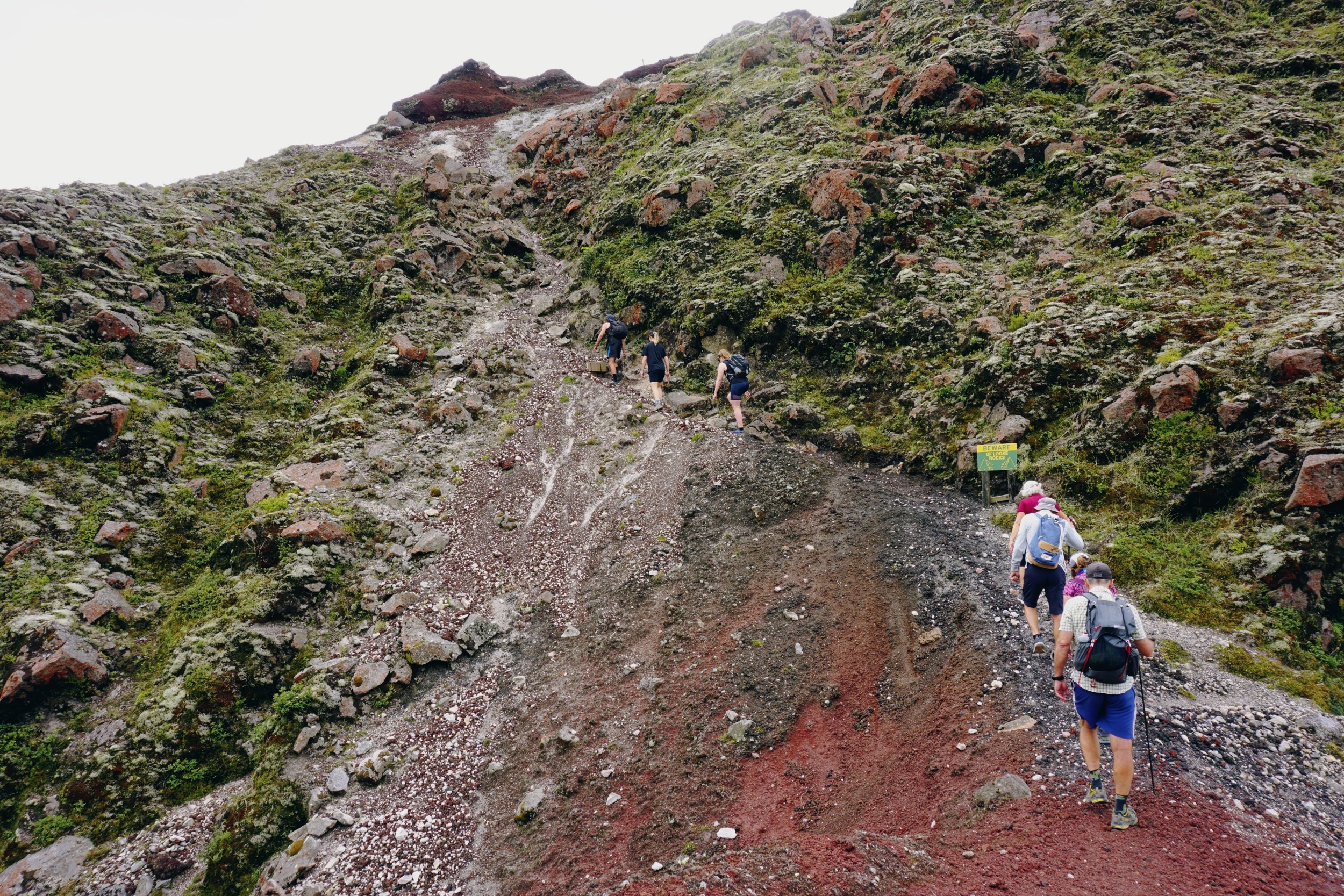
Our first stop was looking down at the main crater from the 1886 eruption. Dan also pointed out the scree run that would take us down to the crater. If you’ve not had the pleasure of walking on scree - it’s loose stones that form or cover the slope of a mountain. A lot like skiing but on dirt. We all laughed, surely he wasn’t serious? It was bloody steep man! Don’t worry, your guides will show how to safely walk on scree and you can go as fast or slow on the scree run.
Did you know that the Americans built the road up to Mount Tarawera during World War 2? They got permission to build a base on the mountain and you can still see the airstrip today. Unfortunately for them, by the time the base was finished, the war had ended. So, they left. Then the New Zealand Government was like, excuse me, come back and pick your rubbish please. Probably not in those exact words, but it worked because the Americans came back and packed up the base…then dumped it all in Lake Rerewhakaaitu. I bet they didn’t teach you that bit of history in school!

Not far from the summit is a section nicknamed the Hillary Step. Basically the point of no return according to our guide Dan. It’s a short, steep rocky section that probably wouldn't be too pleasant in high winds. Much like the more famous Hillary Step on Mount Everest.
The summit is 1,111m above sea level, although the elevation gain is much less than that. Definitely less than 200m, but I didn’t really keep track. I really enjoyed seeing Mount Pūtauaki (Mount Edgecumbe) and Moutohorā/Whale Island in the distance. It was a bit hazy, but we could still make out Whakaari/White Island in the distance. Geez, it just felt like a stroll in my backyard.
From the summit, the track winds down to the start of the main scree run. Dan talked us through good scree walking technique: Bend the knees, dig in the heels, step onto the small dirt mounds instead of footprints and lean back. I felt a bit gumby a first, but once I eased into it, it took the pressure off my knees. I wish I knew this before I did the scree section on the Tongariro Crossing!

The scree run!
Looking down into the crater from the top of the scree run felt like madness! We were so high up. But you know what, this was actually the highlight of the tour for me, like legit. Once you relax into it, it’s not that hard to keep your balance and I even started to get into a bit of a jog until my knees started to creak. Then I stopped halfway down and looked around me. We looked like ants compared to the giant crater!
Once everyone made it down from the scree run, Dan talked us through the different volcanic rocks all around us. We laughed when he picked up some of the rock samples nearby, which must have been from an earlier tour. I was glad I wore my gaiters after watching the others emptying out their shoes. There’s one final uphill section that will take you up to the car park, affectionately known as ‘The Punisher’. Disjointed wooden steps on more scree will definitely get the quads and lungs, so take your time and enjoy the view.
I was pretty blown away with this tour, it’s legit awesome. I did wish the walk was longer, but that’s just because I love walking. A big shout out to our guides Dan K and Jordie from Kaitiaki Adventures. They were super friendly and full of knowledge - I learned so much!

Walking out of the crater.
fivefootronna is Ronna Grace Funtelar - a thirtyish adventurer, graphic designer and writer. A woman with a curious mind who lives for hiking mountains, outdoor adventures and eating pizza. She has a unique brand of optimism that is a combination of her great enthusiasm for life and cups of coffee during the day.