Bay of Plenty: Hiking the Western Okataina Walkway
Seniors DoC Ranger Mayer on the look out for wallabies and deer tracks.


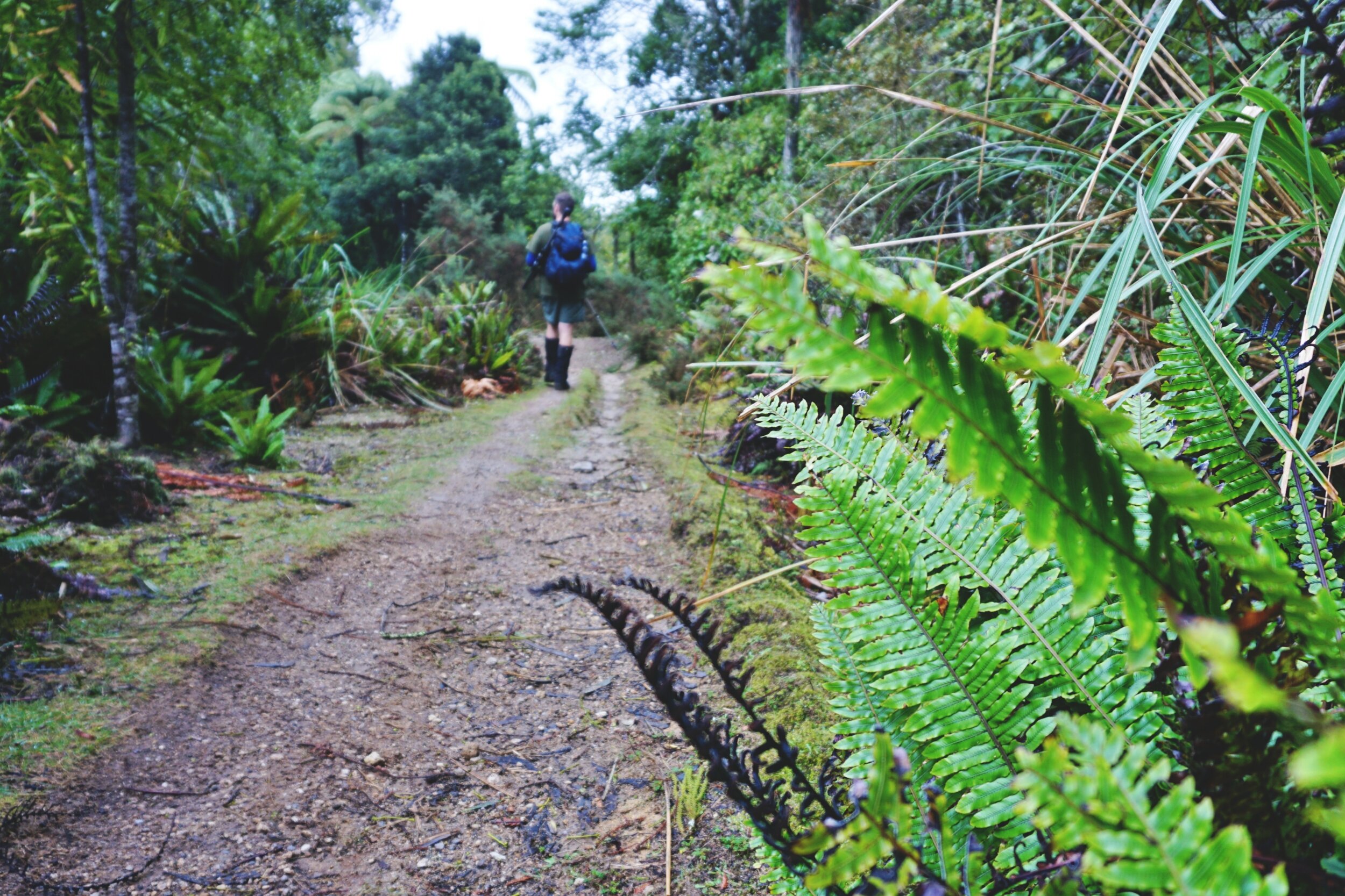
The start of the track at the Western Okataina Walkway.
No matter how quiet you try to be at 5.30am, everything just seems louder somehow. It was an early start because I was on my way to Rotorua to meet up with Senior DoC Ranger Mayer (has quite a nice ring to it doesn’t it?), my hiking buddy for the day.
We planned to walk the 17km Western Okataina Walkway starting at the Okataina Outdoor Recreation Centre and finishing up at Millar Road at Okareka. The track can also be walked from Te Ruato Bay in Lake Rotoiti, but we decided to save ourselves a couple of hours and go from the recreation centre instead.
Getting There
Start of the track: The turn-off to Lake Okataina is on SH 35, about 40 minutes from Whakatāne and 20 minutes from Rotorua. Follow the windy road and keep an eye out for the signs to the outdoor recreation centre. End of the track: We left a car at Millar Road at Okareka (the car park is close to the end of the road) as this was our exit.
According to the Department of Conservation (DoC) website the track is an advanced tramp, but you wouldn’t know it from the first 30 minutes. The mist in the mountains made the forest quite dark and felt more like twilight than early morning. As the track suddenly headed uphill, I struggled to keep pace with Mayer. He wasn’t going particularly fast, but he was also a foot taller than me. I did my best to put one foot in front of the other and to keep him insight.
He must have noticed how much louder my breathing had gotten, and was nice enough to give me a couple of minutes to let me catch my breath. The track just keeps going up for about 20 minutes and by the way it’s been cut, this was made for MTB riders. Depending how fast you ride it, the steepness can definitely give you some air.

With the overcast day, there wasn’t much of a view at the Whakapoungakau Trig.
During a flat patch, my lungs had found their rhythm again. We had been chatting away when Mayer stopped mid-sentence, dropped his hiking pole and beanie and got the rifle. He told me later that he had seen a wallaby hopping across the track before it quickly disappeared into the bush. Mayer bent down and showed me the wallaby footprints in the dirt - some were faint, while others more obvious. I had seen a stuffed wallaby many years ago, when I worked at the Bay of Plenty Regional Council, just never a live one.
I hadn’t really planned on going to the trig that day because it was overcast, but we went because Mayer was keen to see the trig and check the track conditions. The trig was beautiful in the mist, though as predicted the view was a white-out. It gave Mayer a chance to teach me about how to identify trees - which really highlighted the fact that even though I spend a lot of time in the bush, I wasn’t very good at naming them!
He pointed to a nearby tree and asked me if I recognised it. Nope. He pulled a leaf off for me and then for himself and asked me to taste it. The delicious peppery kick doesn’t hit you for a few seconds, but oh man it’s definitely there! The Horopito leaf can pack a punch, and my tongue was still feeling the effects as we made our way to the junction.

Horopito leaves have a nice peppery heat to them.
We came across a couple of MTB riders at the Whakapoungakau junction after coming back from the trig. They were riding from Millar Road, where we were heading, so we had a quick chat to ask about track conditions ahead.
"You're Ronna, right?" One of the guys asked. I must have had a confused look on my face, so he followed up with, "We used to do musical theatre together. You know my dad."
I suddenly clicked.
It was Sam, Bill's son. Bill Clarke's taken me on a few hīkoi / walks at Ōnepu and the Karaponga Reserve (it’s on SH 35 on the way to Rotorua from Whakatāne). If it wasn't for him, I would have never known about the Karaponga Falls. I think the last time I saw Sam he was still at intermediate or high school. He's grown up a bit since then.
“Is that your car with the broken window?” Sam asked, trying to keep a straight face. Wait, that’s my car at Millar Road! Then we all laughed and continued in opposite directions.

The Whakapoungakau junction.
A lot of the track is pumice or sand, which meant good drainage. The muddy patches were mostly in the forest. The terrain was steep in a few places, though we also did go through large sections that were flat. I think what makes this an advanced tramp is the distance - it’s 17km one way, plus a couple more if you include the trig. Start early and plan for a long day, that way you will have plenty of daylight to enjoy the views.
Mayer continued to point out the wallaby footprints and later we even began to see deer tracks. Because hunting wasn’t our priority (Mayer called it ‘opportunist hunting’), he couldn’t really veer off track and go into the bush. Earlier I joked that if he was to shoot anything, could do it at the start of our tramp or towards the end so it wouldn’t be too far to carry it to the car.

We didn’t really know where we would stop for lunch, so we let our stomachs decide. I stopped on a down-hill section that gave a wide-berth to any riders speeding past. It turned out that we wouldn’t see any more riders that day, but we did see some trail runners. For our shared lunch I had brought some chorizo, Camembert and Putok (Filipino bread), while Mayer brought hummus and crackers. You know you’ve had too much hummus when you’re still burping garlic on the drive home.
The easy, sloping down-hill helped warm up my legs after lunch, especially as the temperature felt like it had dropped a couple of degrees. As the track continued to slowly flatten, we came across a river crossing ahead sign. Mayer and I looked at each other a bit surprised after seeing the sign. It turned out that the signs are now redundant as there was now a culvert in place.

Winter tramps have less daylight hours, and I’ve definitely become much more aware of it during tramps over 15km. I had even packed my head torch in case we finished in the dark - unlikely, and was happy that I didn’t have to use it.
I was relieved to see the back of the signboard at Millar Road, and even did a bit of a happy dance. My legs didn’t feel too bad, but my body was starting to feel the effects of my 5:30am start. After stretching and a quick snack, we drove back to Lake Okataina to pick up Mayer’s car. My stomach was rumbling and being a foodie, all I could think about was dinner. I had the biggest craving for steak, and poor Mayer had to listen to me talk about it for 20 minutes solid. What a champ!
If you plan to tramp the Western Okataina Walkway, I recommend having a car at each end (or arrange a pick up time) so that you only need to walk one way. We took seven hours (including lunch and the trig) to tramp the 17km from the Recreation Centre to Millar Road at a steady pace. The tramp is challenging because of the distance, so take your own fitness into account. Happy exploring!

Yay! We finally made it back to the Millar Road carpark.

fivefootronna is Ronna Grace Funtelar - a thirtyish adventurer, graphic designer and writer. A woman with a curious mind who lives for hiking mountains, outdoor adventures and eating pizza. She has a unique brand of optimism that is a combination of her great enthusiasm for life and cups of coffee during the day.