Discover Our Local: Walking the Pakihi Track (Pakihi Rd to hut & return)

On the Pakihi Suspension Bridge on a beautiful Winter's day. To the right (as you walk onto the bridge), you can still see remnants of the original bridge that was damaged in a storm.
I have been planning on walking the Pakihi Track since I came across a photo of the suspension bridge earlier this year. Unfortunately at this time, there is a massive slip that has taken out a part of the track about 300m upstream of the Pakihi Hut, so I couldn’t start my hike from Motu Rd. Instead I walked from Pakihi Rd to the hut and back on the same day. It was still an 18km hike, and was glad to finally make use of the hiking poles I bought as fatigue began to set in on my legs on the way back.
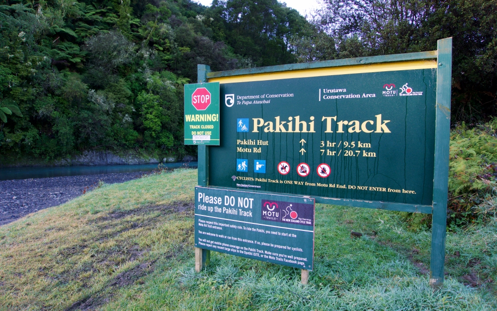
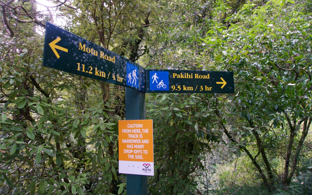
The Pakihi Track is a 20.7km dual use track for walkers/runners as well being a Grade 4 MTB track. Riders can only ride downhill, starting at Motu Rd. Walkers and runners can go both ways. I hope to see the other half of the track once the slip has been repaired - you can keep an eye on the Department of Conservation website for track updates, or head to the Motu Trails Cycleway on Facebook. For shuttle drop off and pick up, make sure to contact Motu Cycle Trails.
“Did you know that the track was first carved out in 1905...with hand tools? ”
I left Whakatane just before 8am, and my first stop was at Two Fish Cafe in Opotiki for a triple-shot soy mocha. Early start and a long day in the bush warranted a decent coffee. It was also a nice surprise to run into Indi, a former dancer at the studio. Her parents own the cafe, and she was there having breakfast with her grandmother before she headed back to Auckland that day. Before I headed to Pakihi Rd, I made sure to text my friend Susan who also lived in Opotiki, so she knew what time I expected to be out later in the afternoon.
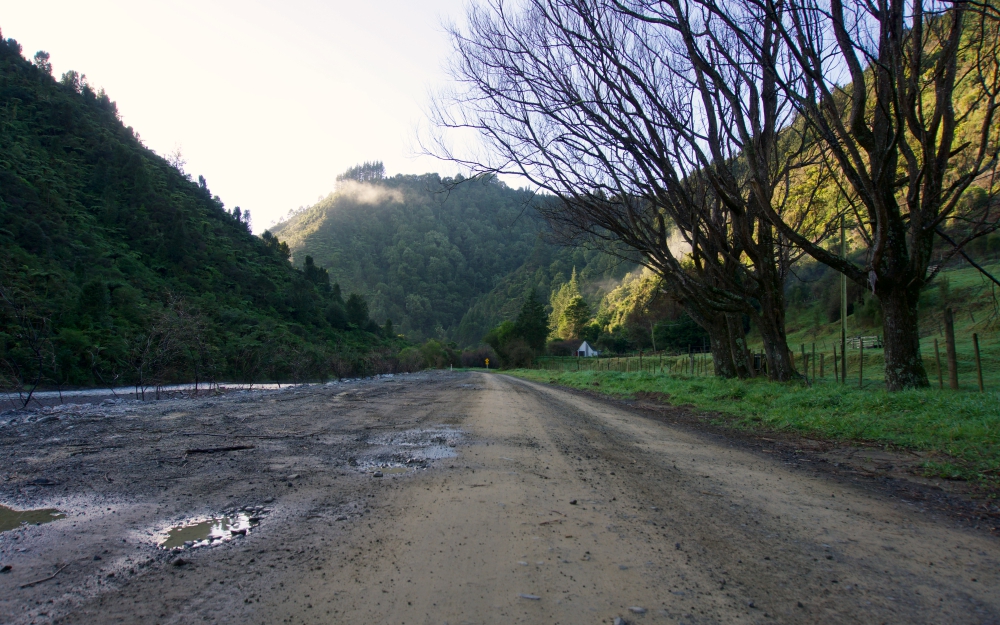
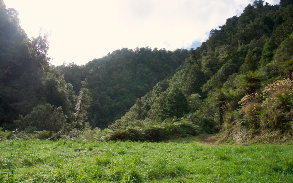
Allow for a 35 minute drive from Opotiki to the Pakihi Rd carpark. Many sections are windy and narrow, with a speed limit of 30km p/hr for a good reason!

A private suspension bridge marked with a closed gate - there were several houses along the track. The gate was open on my way back, but decided not to cross in the end.
The track follows the flow of the Motu River, and you follow the river upstream if you walk from Pakihi Rd. Before the 1km mark, I came across a small suspension bridge which lead to a secluded house on the other side of the river. Not going to lie, I thought it was pretty cool. There was a small closed gate, so I respected their privacy and moved on.

The first bridge from the Pakihi Rd car park, and the last you pass if you ride down on the Grade 4 MTB track.
Did you know that the track was first carved out in 1905...with hand tools? They had hoped it would become the road that links Motu and Opotiki, though unfortunately it didn’t turn out that way. The track is popular with trampers and hunters, and a few were staying at the hut that weekend.
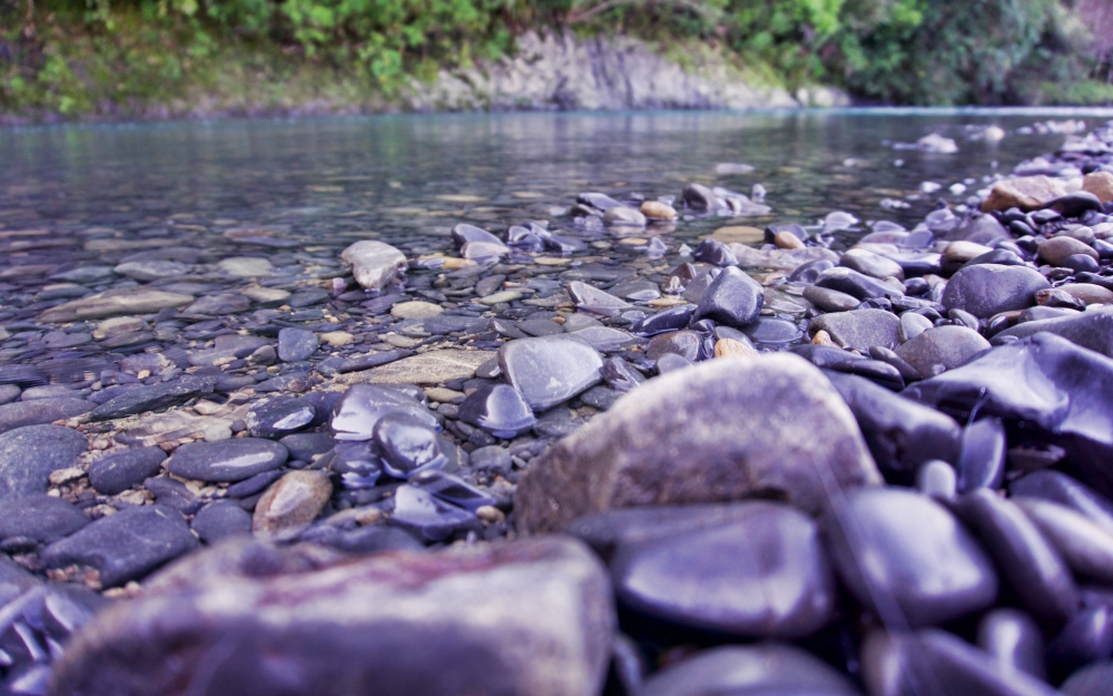
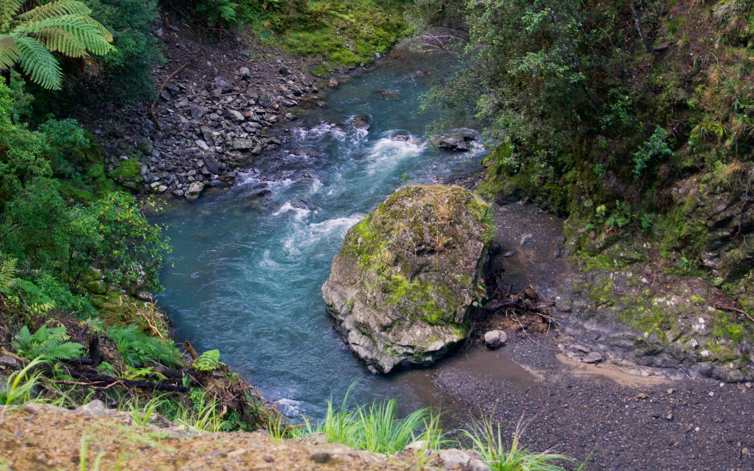
There are 25 of these bridges in total - as I was walking the track counterclockwise, this is technically the last bridge. As you get further into the bush, there were cascading waterfalls of varying sizes which fed into the streams beneath the bridges. Even along the track, there were thick moss that had a constant trickle of water. Everywhere you turned there was life beaming - birds singing, a flowing river in various shades of turquoise, the sun’s rays warm enough to make me sweat even on a Winter’s day. To put simply...glorious.
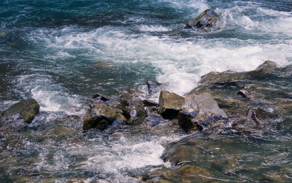


I stopped for lunch by the river just after the 4km mark. OK so part of the track washed away which meant I had to walk down to the river anyway. Coming across multiple ‘rock zones’ and hazards explained why this is a Grade 4 track - certainly not for the faint-hearted. Exploring places like this made me wish I had invested in some gaiters, but my waterproof hiking boots did the job to keep my socks dry.
Earlier in the year, I invested in a pair of OnePlanet boots from and Bridgedale socks - both purchased from the Whakatane Great Outdoors. For great advice and outdoor gear, talk to this awesome Irish fella named Andrew.

The five foot Asian at the 5km mark on the track.

The walk to the hut took me about 4 hours, which included stopping for lunch and photos. I managed the walk back around 3.5 hours, with the help of my hiking poles in the last 3km due to fatigue setting in on my legs. It isn’t a hard walk, just long. As I’m prone to cramps, I made sure to pack food that help replenish my salt levels. Thanks for a nice day out Pakihi, I will definitely be back again soon.
Photographs by Ronna Grace Funtelar | Camera: SonyA6000
fivefootronna is Ronna Grace Funtelar - a thirtyish adventurer, storyteller and curious optimist. A woman who lives for hiking mountains, outdoor adventures and eating pizza. She has a unique brand of optimism that is a combination of her great enthusiasm for life and cups of coffee during the day.